The fastest way to generate 3D analysis-ready geometry for complex geotechnical projects.
Design complex 3D geometry with BUILD3D
Rapidly create analysis-ready 3D geometry for geotechnical analysis
Go to storeTry it nowSave time with feature-based design
Take advantage of the many time-saving geometry creation tools. Access powerful Boolean operations, generate meshes in one click, and easily integrate analyses from other applications.
Make modifications in any point of a model’s design history and watch the changes cascade through the entire model.
No project too big or complex
Import a broad range of data and files (such as CAD) to design and plan dams, levees, roads, bridges, embankments, open-pit mines, underground tunnelling excavations, and more.
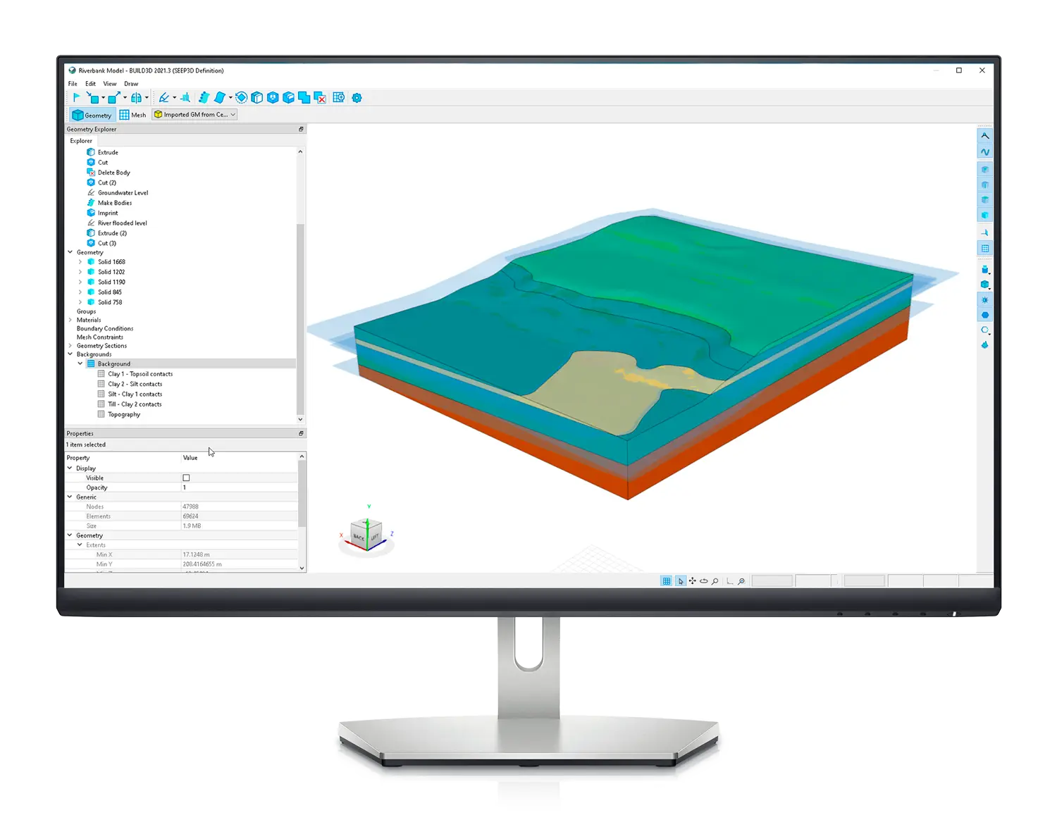
Seamlessly construct a 3D geotechnical geometry with complex topography or geology, such sweeping tunnels or winding rivers.
Enrich with GeoStudio data
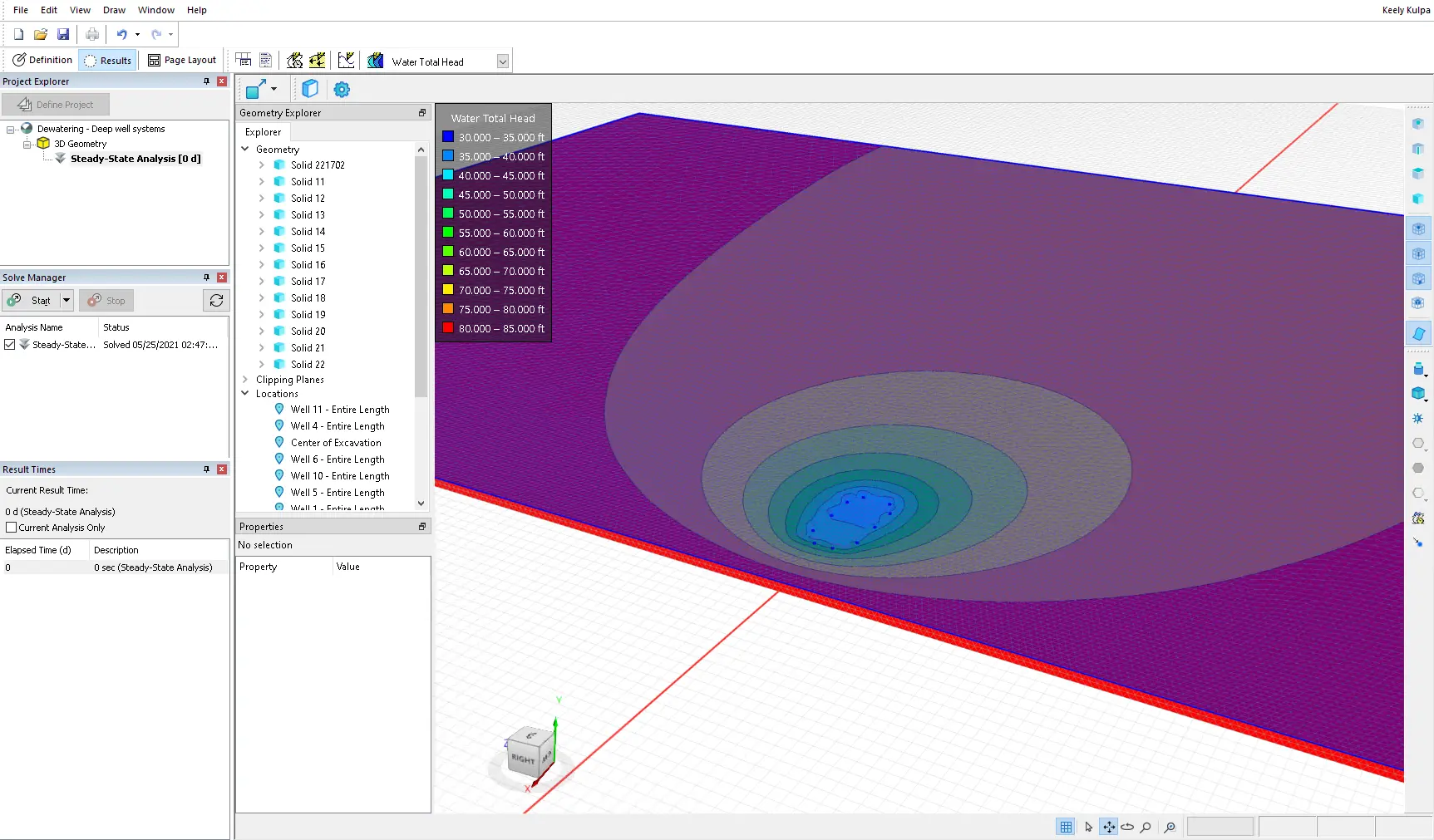
Create a full design picture showing risk, complexity, and opportunities for engineering safely and effectively. Integrate with any 3D GeoStudio analysis product or generate 2D cross-sections for use in 2D GeoStudio analyses.
BUILD3D is part of GeoStudio integrated geo-engineering software
Learn moreBUILD3D Stories

GeoStudio Answer Hour: New Features in GeoStudio
GeoStudio 2024.1 continues to build on Seequent’s geotechnical analysis solution, with the addition of many…

Integrate, communicate, and interpret geotechnical data
with industry-leading geo-engineering numerical modelling
Try it nowKey features

Fast and flexible model creation
Save time with feature-based geometry, then get greater flexibility and precision with NURBS-based geometry.
Import data to enhance your model
Import 2D GeoStudio analyses with previously defined materials and boundary conditions. Import bodies, profiles, and background mesh, including formats SETP/STP, IGES, STL, DWG/DXF.

Analyse pit excavation scenarios
Import pit shell surfaces and geological formations from CAD files, then use the cut features to remove material in the excavation and set up multiple analyses to simulate the impact of pit excavation.

Powerful tools for sweeping bends
Employ the plane and sketch features to generate road and embankment cross-section geometries and then sweep the cross-section along a defined path.

Rapid, easy mesh generation
Generate the finite element mesh throughout a 3D domain with the click of a button to produce a clean mesh, removing the need to spend hours on manual adjustments.
Useful Information
System Requirements
We recommend you use Windows 10, with a reasonably fast processor, mid range graphics and 32GB of system memory.
Supported Data/Formats
Supported kinds of data and formats that you can use with GeoStudio.